Rain radar
Regional 240 km radar — Peninsular Malaysia, the Strait of Malacca and nearby Sumatra. Frames every 15 minutes.

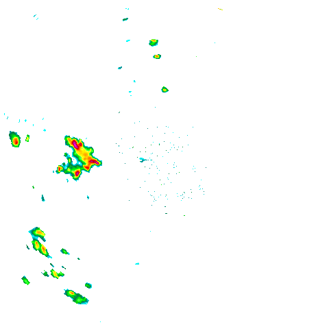
Town-level rain is on the 50 km map. This range is for systems approaching Singapore. Street/Satellite stay zoomed out to the radar disk — each cell is about 1 km.
Last updated: 10 Oct 2026, 02:30
Rain Intensity (mm/hr)
Map Overlays
About the Singapore Rain Radar
The Singapore rain radar on this page displays real-time precipitation data sourced directly from the Meteorological Service Singapore. The rain map is updated every 5 minutes, giving you an accurate, near-live view of rain areas across Singapore right now. Use it to find out where it is raining in Singapore before you leave home or while you are out.
The animated NEA rain radar loops through the most recent frames so you can see the direction the rain is moving. Official is the NEA outline. Street and Satellite are geographic maps. Use 240 km for Sumatra squalls and 480 km for monsoon bands still well offshore. On 50 km, a town is listed when rain covers a meaningful share of that town (a smaller share if the rain is heavy). Storm motion flags neighbouring towns about to be hit, because the latest radar frame is already a few minutes old. Speckles and rain over water are ignored.
Rain Intensity Guide (mm/hr):
- Light Rain - Drizzle, light showers (0.1-1 mm/hr)
- Moderate Rain - Steady rain (1-4 mm/hr)
- Heavy Rain - Strong showers (4-10 mm/hr)
- Very Heavy Rain - Downpour (10-20 mm/hr)
- Intense Rain - Very heavy downpour (20-50 mm/hr)
- Torrential Rain - Extreme rain (>50 mm/hr)